Pointcloud Analysis: Does my BIM model match the as-built situation?
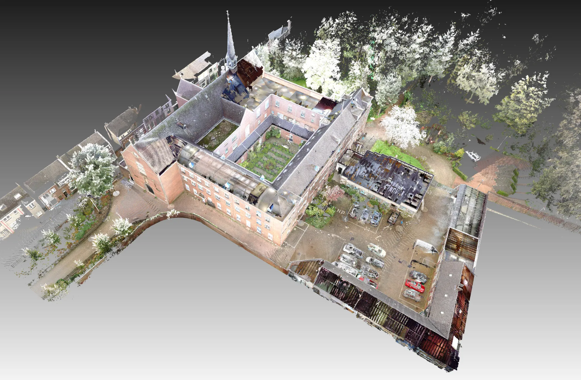
Often, a BIM model of the existing condition is created based on historical drawings, but the question always remains: is it accurate? Recently, we received a request to create a pointcloud for the verification of the BIM model of a monastery, built between 1880 and 1882.
Procedure:
To achieve this, we used static scanners from Farotechnologies to measure the exterior of the monastery and the church, and we used a NavVis VLX mobile mapping device to capture the interior. Control points were measured using a total station for verification of the point clouds, as well as for determining RD and NAP coordinates and establishing a local coordinate system.
We combined all the measurement data into on epointcloud and compared it with the ArchiCAD BIM model of the existing condition. The verification process involved both software analysis and visual inspection.
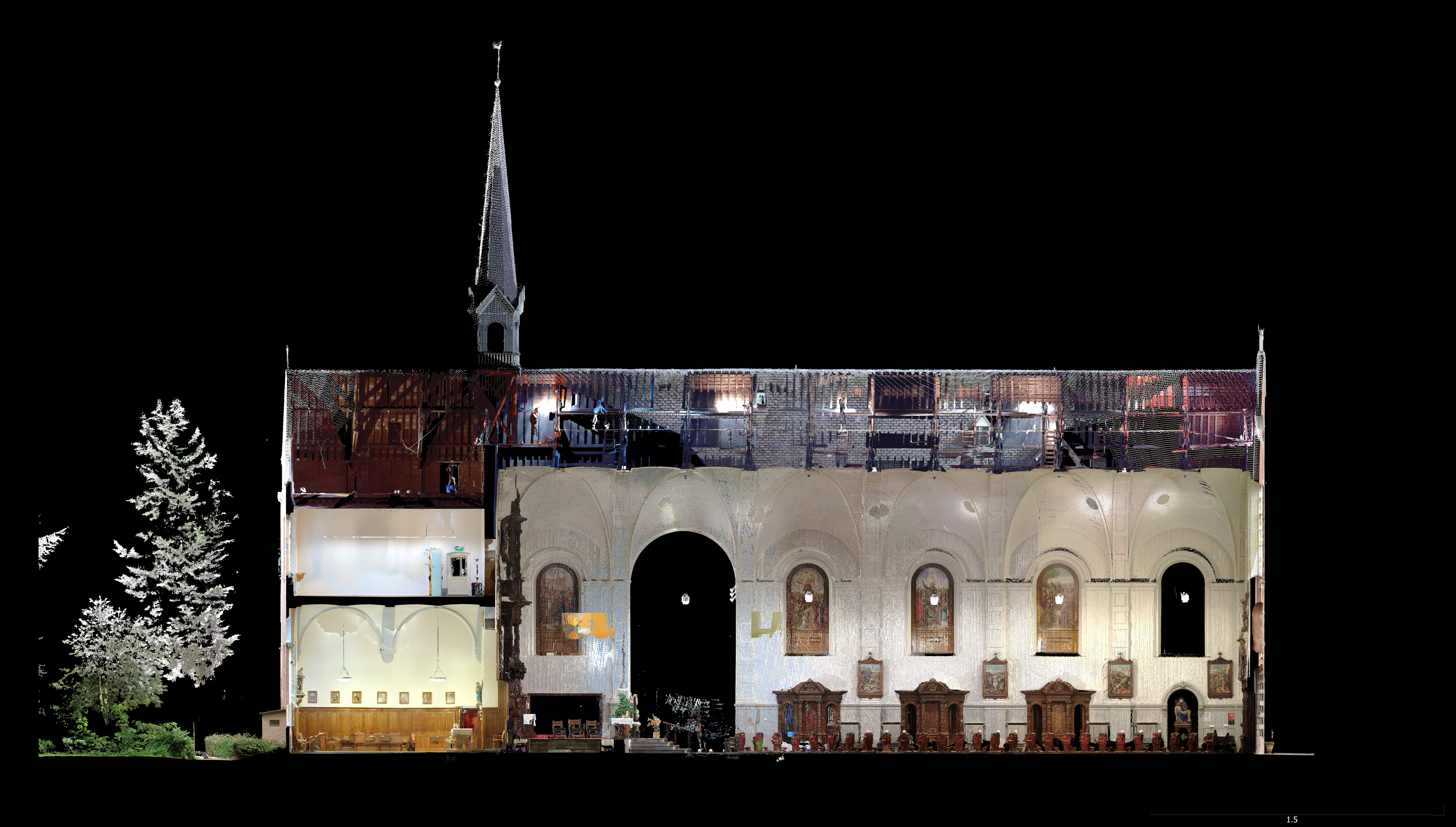
During this comparison, we analyzed various components, including:
- Floor heights and thicknesses
- Spatial layout of floors
- Positions and sizes of wall openings, stairwells, stairs, columns, etc.
- Comparison of the building perimeter with public data
Additionally, in a follow-up phase, specific checks can be conducted on floor slopes and the tilting of walls and columns. In the video, we showcase a fly-through of our pointcloud, which served as the foundation for our analysis.
If you have any questions about the possibilities of 3D scanning and model verification, feel free to contact us. We are more than willing to share our expertise!